
Eight steps to a print
Every picture below is the actual store, photographed on one real file in a single sitting: Strandvejen, a public road along the coast, taken from OpenStreetMap. Nothing is a mock-up, and the numbers on the poster are the numbers that were in the file — except the time, which the file did not carry and which was typed in, exactly as a customer would.
-
The shape of it
Eight steps and a sheet.
The eight steps run down a rail on the left, and the one you are on opens in the panel beside it, so you are never looking at forty controls at once. The sheet takes the rest of the screen and redraws on every choice — it is the same drawing that goes to press, not a preview of it.
Before there is a ride, the sheet says what to do: drop a file on it, or connect Strava.

The first screen: eight steps on the rail, and the sheet waiting for a ride. -
1 / 8
Connect
Two ways in, on one panel. Connect a Strava account once and pick from a list at the top, or drag a file straight in below it — GPX, TCX or FIT, from any watch or phone. Drop several and you unlock the motifs that draw more than one.
The privacy radius sits here, with your data, rather than down among the colours. It is not a question about how the poster looks; it is a question about how much of your address leaves your machine. The default clips the first and last 500 metres; you can push it to two kilometres, or switch it off. Under it, you can crop the route by hand, and only what you keep counts.
Your file is read in the browser. Unless you switch the radius off, the untrimmed version — the one that starts at your front door — is never something we receive.
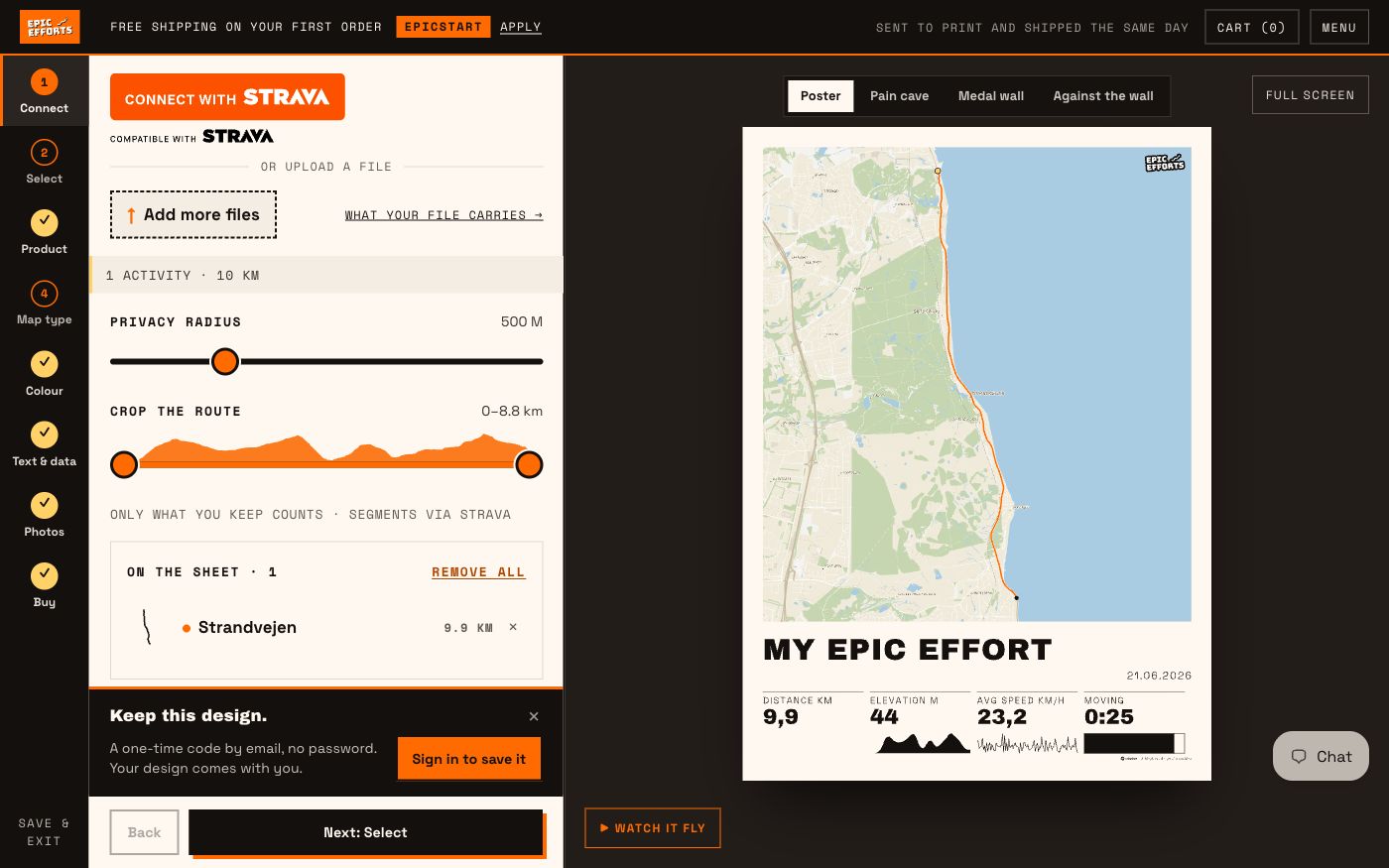
Step one with the ride in: the privacy radius at 500 m, the crop, and the activity on the sheet. -
2 / 8
Select
With one ride there is nothing to decide: the sheet draws it as a Clean line. Everything that needs more than one ride waits below, under Add more routes to unlock — Heatmap, Coverage and Multisport, and the six Data prints, which draw a whole Strava account rather than one outing. Bring a second ride and the route motifs move up beside Clean line; connect the account and the Data prints follow.
The small pictures are not stock images. Where a motif can draw what you have brought, its picture is your ride, drawn by the same engine as the sheet; where it cannot yet, it says Example.
A motif that cannot work with what you have says why, and offers a way forward where there is one. A button that simply does nothing is a puzzle you should not have to solve.
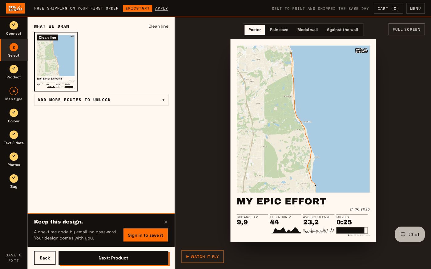
One ride: Clean line, drawn from the ride, and everything else folded under «Add more routes to unlock». -
3 / 8
Product
The object first, then the size, then the paper. A loose print and a framed one are two different things to make, and they are priced accordingly — from 319 kr and from 799 kr. Both show your own poster; the T-shirt and the tote show an example. Sizes are 30×40, 50×70 and 70×100, and the poster starts at 50×70. The six Data prints are the exception: each is its own product at one fixed size, because the motif decides the sheet — The Clock is square at 50×50 and The Curve is 30×40.
Two papers, on framed and loose alike: Museum 250 gsm, an uncoated offwhite archival matte, and Classic 170 gsm, uncoated matte and lighter in the hand. A loose 70×100 is the one exception — it comes in 250 only, because the sheet bends at that size. Framed prints arrive assembled, behind glazing, with the hanging hardware already on. Loose ones arrive rolled in a tube.
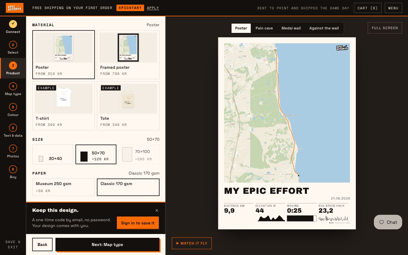
The poster and the framed poster, drawn with the ride; size and paper below. -
4 / 8
Map type
Eight map types: the bare line and seven maps — Lines, Topo, Piste, Nautical, City, Atlas and Satellite. Each tile is your own route on that map, and two maps that would look the same on your route share one place in front — the other waits under More map types. Where a map is used, the print carries the credit for it — that is a licence condition, and it is printed, not implied.
Right under the maps, always in view: what the map shows — roads, towns, water, start and finish (the two dots and the towns at either end) and road names, each on or off — and which towns get a name. Map area is how much air sits around the route, from tight to panorama. The map follows it, so this is the zoom as well as the crop.
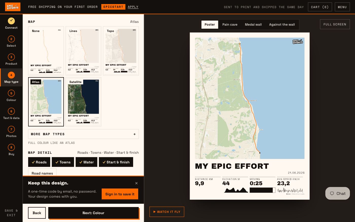
Map types drawn with the ride, Atlas chosen; on flat land the look-alikes wait under More map types. What the map shows and how much of it stands right under them. -
5 / 8
Colour
Background, line colour and line weight. Three backgrounds — Natural, Black and Ember — and seven ready-made pairs of background and ink, Mono (black on white) among them. Each tile is your own poster on that background. At most five stand in front; the rest wait under More backgrounds, and of two that would look the same on your design, only one stands in front. The last tile is Custom colour: a colour wheel with a field for the paper and one for the text, where you choose both yourself. What they change is the ink, not the paper: each one is printed edge to edge over the whole sheet, so the ink covers the paper’s own colour, and the sheet you chose in step three is the sheet you get. Atlas and Satellite keep their own map colours.
Line weight is set in millimetres rather than pixels, so a medium line looks the same on a 30×40 as on a 70×100.
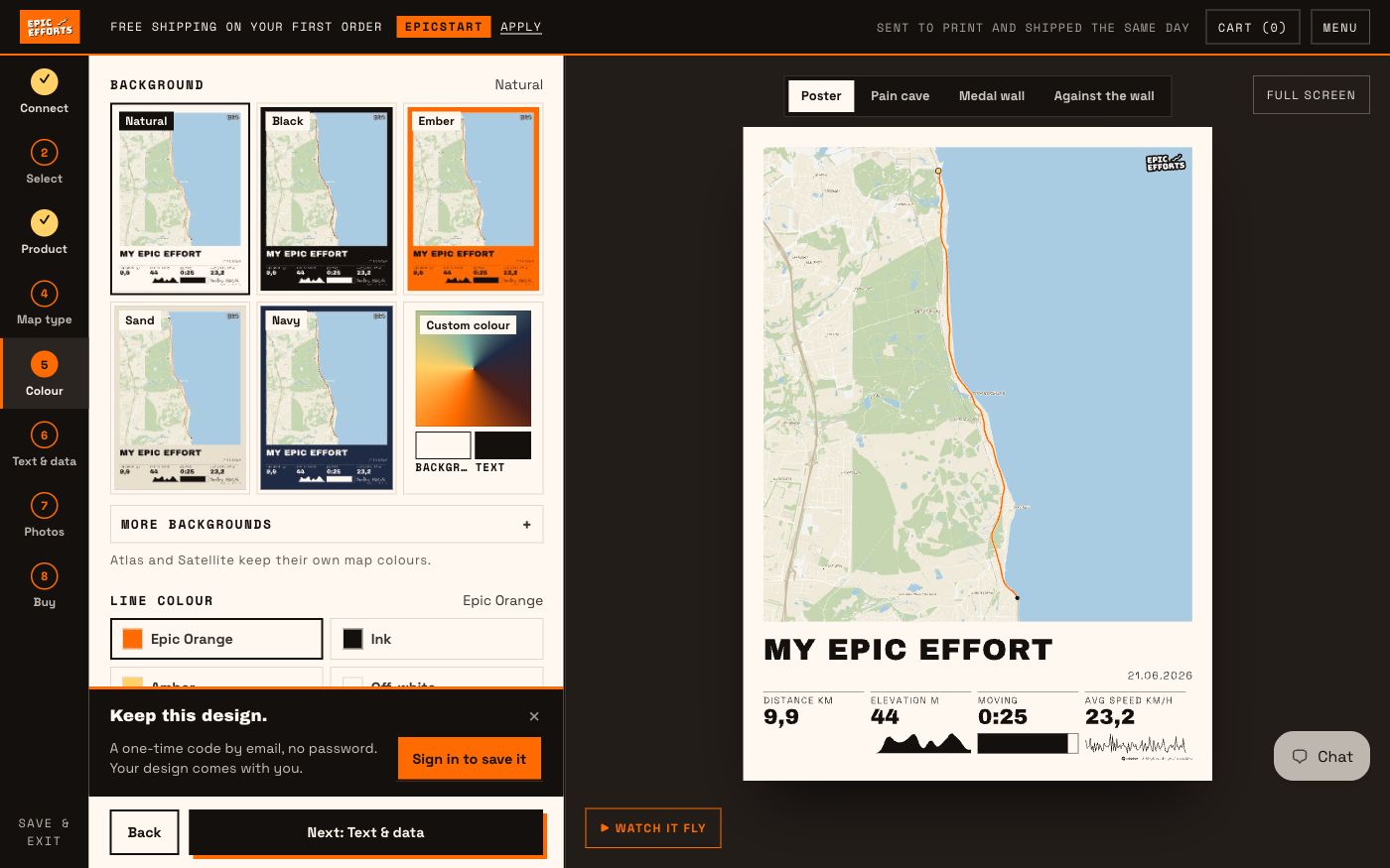
Five backgrounds in front and Custom colour beside them, the rest under More backgrounds; four line colours and three weights. -
6 / 8
Text & data
The headline prints with the numbers, below the map or above it. It starts as My Epic Effort. Three suggestions sit under the field if you want a different one. A T-shirt or a tote carries only the line and our logo.
Up to four numbers go on the sheet, and the list shows the ones your file has. A number that is picked but that the file cannot fill is struck through, and nothing is printed in its place. A file that carries more than fits keeps the rest under More numbers. Some numbers can carry a small chart — the elevation profile and the speed here.
Whatever your file is missing of the time, the date, moving time and steps waits behind one line, and the line names only those — Add time or steps, say. A route someone published has no time; type one and elapsed time and speed open up, in your sport’s own unit. The ride pictured has its own time and date, so only the steps were missing, and their field is open under the list.
The labels are yours to rename. The values are not — they come from the file, and a number you typed can never push a measured one aside.
What your file carries maps out which sources give which numbers. What the numbers mean goes through all nineteen and every chart — what each one measures, and why it is drawn the way it is.
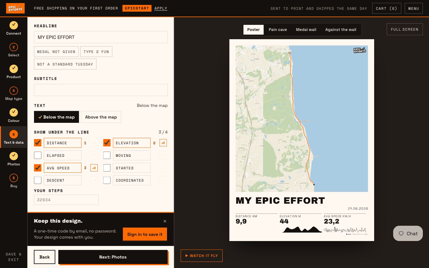
Three numbers on the sheet — distance, elevation and average speed, two of them with a chart — and the field for the one thing the file did not carry: steps. -
7 / 8
Photos
Up to five photos of your own, as pins on the map or in a strip. Drop them on the box or click it to choose them — the same box your ride files went into. A photo that knows when or where it was taken is pinned to its spot on the route, and the pins can be dragged; one that does not goes in the strip. Photos taken near the start or the finish are left out. Each photo in the list has a × that takes it off the sheet again.
Add none and the sheet is the route alone, as it is here.

No photos yet: the route alone, and the box waiting for up to five. -
8 / 8
Buy
The bill shows what costs something and what does not. On this poster the only addition is the size, 50×70; everything else is included, and the line at the bottom is the item that goes in the basket.
Above the sheet, from every step, the poster can be hung up: in a pain cave, on a medal wall, or leaned against the wall at home. It is the same drawing, fitted to the frame in the photograph. When your size is close to the frame’s, the gap is your poster’s own paper and the caption names the frame; when it is far off, as on a square print, the caption says what size that frame is and what size yours is.
Your order goes to print the same day you place it. Until it has been printed you can cancel it yourself and be refunded in full.
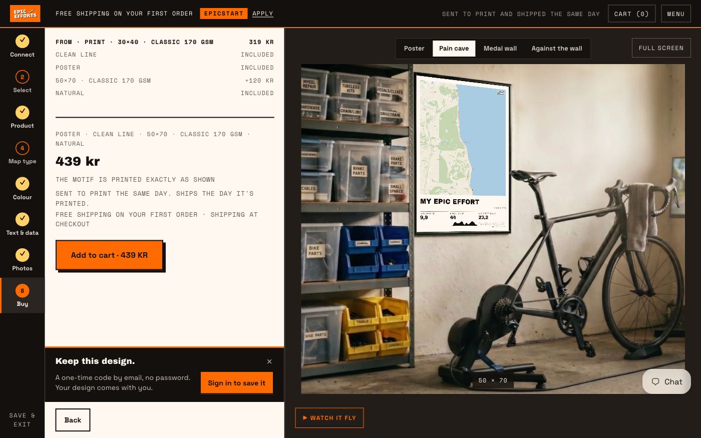
The bill, the price and one button — with the poster hung in the pain cave. -
+
See it full screen.
Available from every step, with the same four views. It is the same drawing enlarged, not a second image — what you approve is what we print.
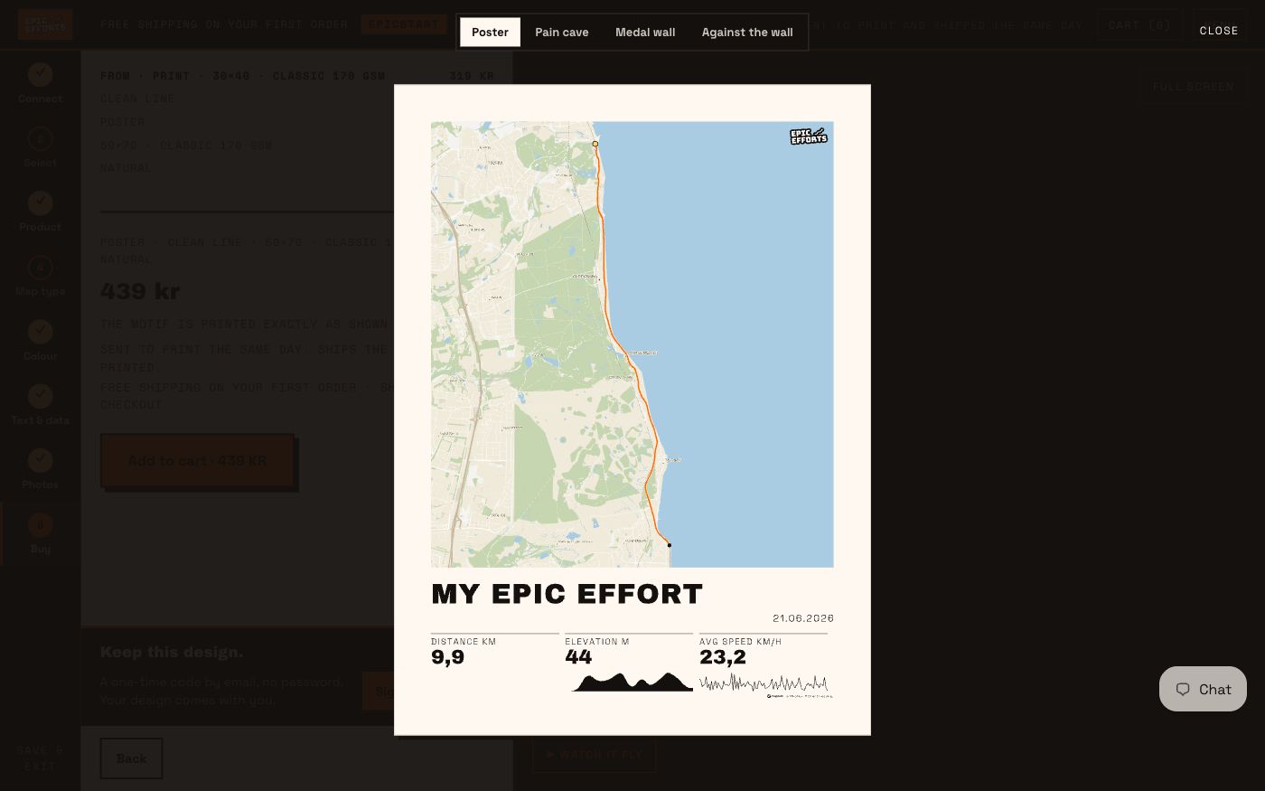
9.9 km · 44 metres of climb · 23.2 km/h, and the date the ride was taken. Mapbox and OpenStreetMap credited on the print itself.


What you see is what we print
No surprises between the screen and the wall.